Canada
- Conventional cycle: 24 elevation angles scanned in 5 minutes to obtain a tri-dimensional view of the atmosphere within 256 km of the radar in reflectivities.
- Doppler cycle: 4 angles scanned in reflectivity and velocities, the first three in a range of 128 km and the last within 256 km. This cycle is used to locate possible small scale rotation and shear in the wind pattern as well as the large scale circulation. The velocity data help to filter artifacts in the reflectivity, like ground echos, too.
Only the McGill radar (J. S. Marshall Radar Observatory) using its coherent S-band transmitter acquires reflectivities and velocities during each of its 24 elevation angles: 5 minute cycle time.
New Concepts in Scanning
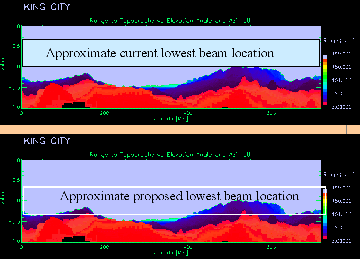
LoLAA: Lowest Level Application Angle
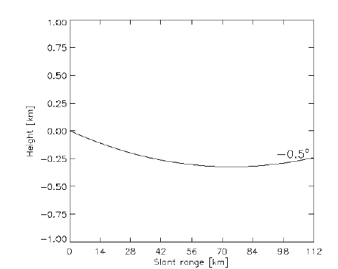
- Radar beam is at the radar horizon for areas of interest
- half the beam's power is lost into the ground (~ 3 dB)
- will see most of the weak low-level snow in the winter
- reflectivities not directly related to precipitation rate
BALD: Best Angle for Long Distance
-
Center of beam is half beam width above the radar horizon
-
Most of the beam clears the topography
-
New lower elevation will be used at long ranges
-
also used in constructing CAPPI products
-
-
May suffer from some blockage
-
CAPPI may be less quantitative at long ranges
-
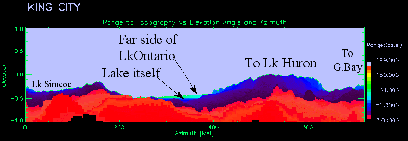
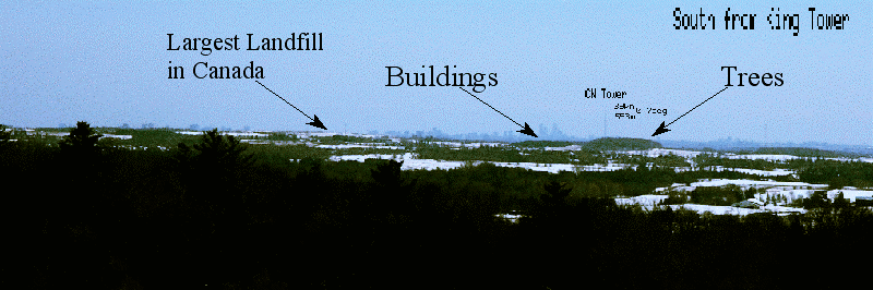
Digital elevation map is not necessarily up-to-date. The view from the King City, Ontario radar toward the City of Toronto
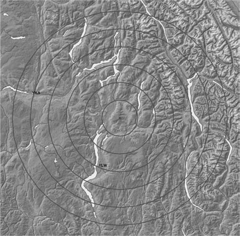
Negative Scan Angles

If the radar is sited on an elevated site, a hill or mountain, then the issues surrounding the range/height of the beam are exacerbated. For those sites, examples are Silver Star and Mt. Sicker in British Columbia or Mont Jolie in Quebec, the lowest scan angle is often negative. Consider the terrain map of the area surrounding the radar at Silver Star, B.C. shown in the image below.