A bow-shaped line of convective cells that is often associated with swaths of damaging straight-line winds and small tornadoes. Key structural features include an intense rear-inflow jet impinging on the core of the bow, with book-end or line-end vortices on both sides of the rear-inflow jet, behind the ends of the bowed convective segment. Bow echoes have been observed with scales between 20 and 200 km, and often have lifetimes between 3 and 6 h. At early stages in their evolution, both cyclonic and anticyclonic book-end vortices tend to be of similar strength, but later in the evolution, the northern cyclonic vortex often dominates, giving the convective system a comma-shaped appearance.
Four identified bow echo patterns each showing an area of weaker echoes called the rear inflow notch. This area develops prior to the development of the bow structure.
| June 8, 1995 at 00:48Z |
 |
| June 8, 1995 at 00:53Z |
 |
| June 8, 1995 at 00:58Z |
 |
| June 8, 1995 at 01:03Z |
 |
| June 8, 1995 at 01:13Z |
 |
Winds in the last image were around 130 km/h
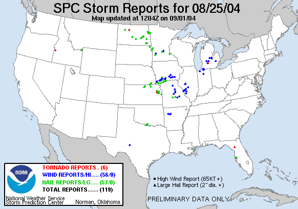
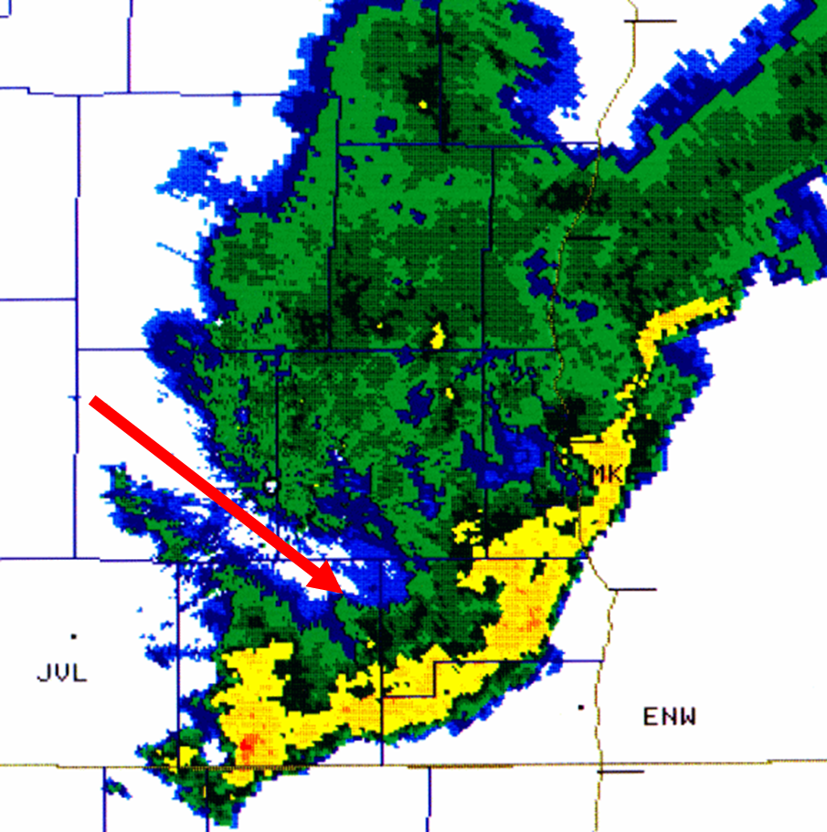
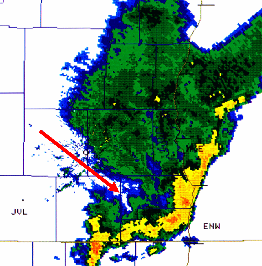
The Iowa bow echo of August 25, 2004
On August 25, 2004, a bow echo moved across southern Iowa. This set of images is interesting because of the "bookend vortex" apparent on the northern edge of the bow echo on the radar scans.
A bookend vortex is a local eddy caused by large variations in the wind field over a small area--for example, a SW wind at 150 km/h next to a SW wind of 30 km/h. This shear induces a vortex to form, and often the most severe wind damage (as well as occasional tornadoes) is seen here.
The bookend vortex got its name because often there is a pair of them, one on the south side and one on the north side of the bow echo, both of them essentially bookending the bow echo itself.
The first bookend vortex can be seen from the beginning of the loops, with the vortex breaking off and moving just south of Des Moines. The second becomes apparent at about 18:31Z, with the curl becoming evident on the north edge of the bow echo.
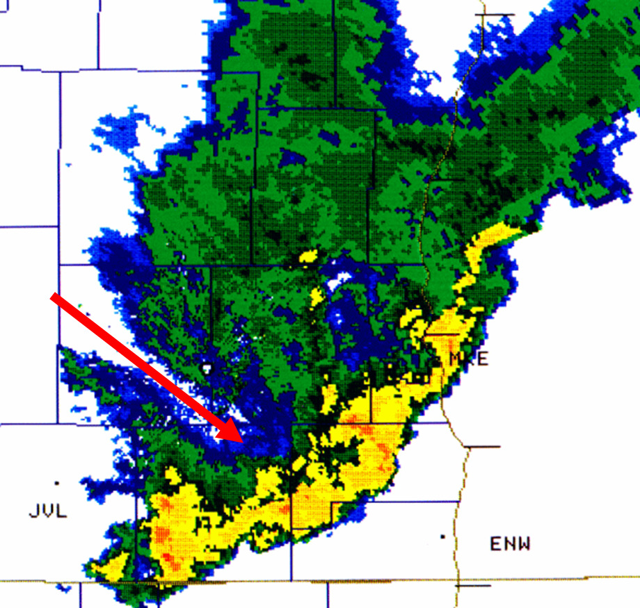
The storm-relative velocity fields show this shear zone very strongly, and in fact, the signature is very similar to that of a tornado. For this reason, bow echoes often have tornado warnings associated with them. The damage associated with this bow echo can be seen in the image below.
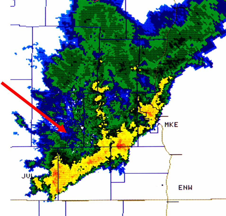
Level 2 reflectivity image showing bow echo with bookend vortices
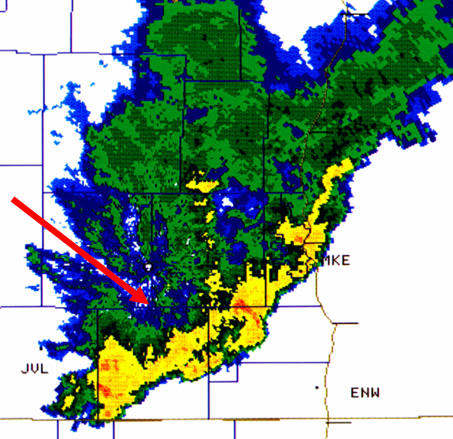
Level 2 radial velocity images of the same bow echo
Storm-relative velocity images of the same bow echo