Echo Tops/TOPS
One of the significant features of a severe thunderstorm is the strength of
the updraft. This results in very tall thunderstorms. The maximum height
of the radar echo is used as an indicator of the height of the thunderstorm.
So the Echo Top Height is a map in plan view of the maximum height of the radar
data. Some flexibility in the product can be built in by specifying that
only radar data above a threshold intensity value will be considered. Another
consideration is that point targets like aircraft can give false readings.
So an additional criterion is that isolated target are not considered.
This is achieved by requiring that for a radar bin to be considered as the highest
radar bin, there must be a valid radar bin in the scan just below. That
is, vertical continuity or contiguity is required. This assumes that airplanes
fly well above the storm tops and that the resolution in the vertical is fine
enough!
In Europe, some radar systems, like those in Finland, allow selection of the thresholds used to produce the echo top product, so a 50 dBZ echo top is possible as is a 10 dBZ product. In general, a -10 dBZ threshold is used; this corresponds to the visual cloud top reported by pilots.
URP does not have this kind of functionality. Instead, a 7 dBZ threshold is used, which is the likely height of the precipitation.
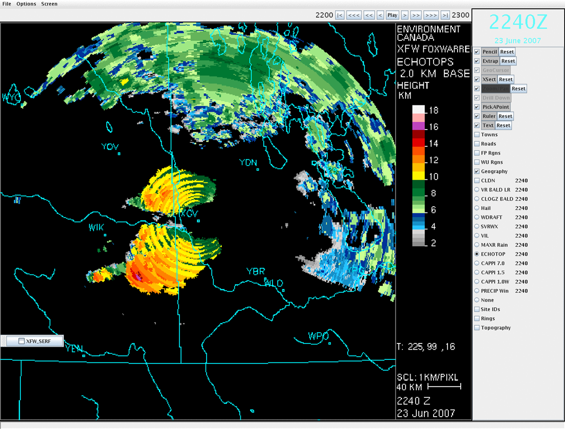
Echo top image prior to the Pipestone F3 tornado. Note that tops in the supercell were in excess of 18 km.
A new smoothing algorithm is being tested. It use an algorithm based on knowledge of neighbouring elevation angle sweeps and radar bin vertical dimensions to adjust the height of echo tops without violating data. The same image of the Pipestone supercell after smoothing is shown below.
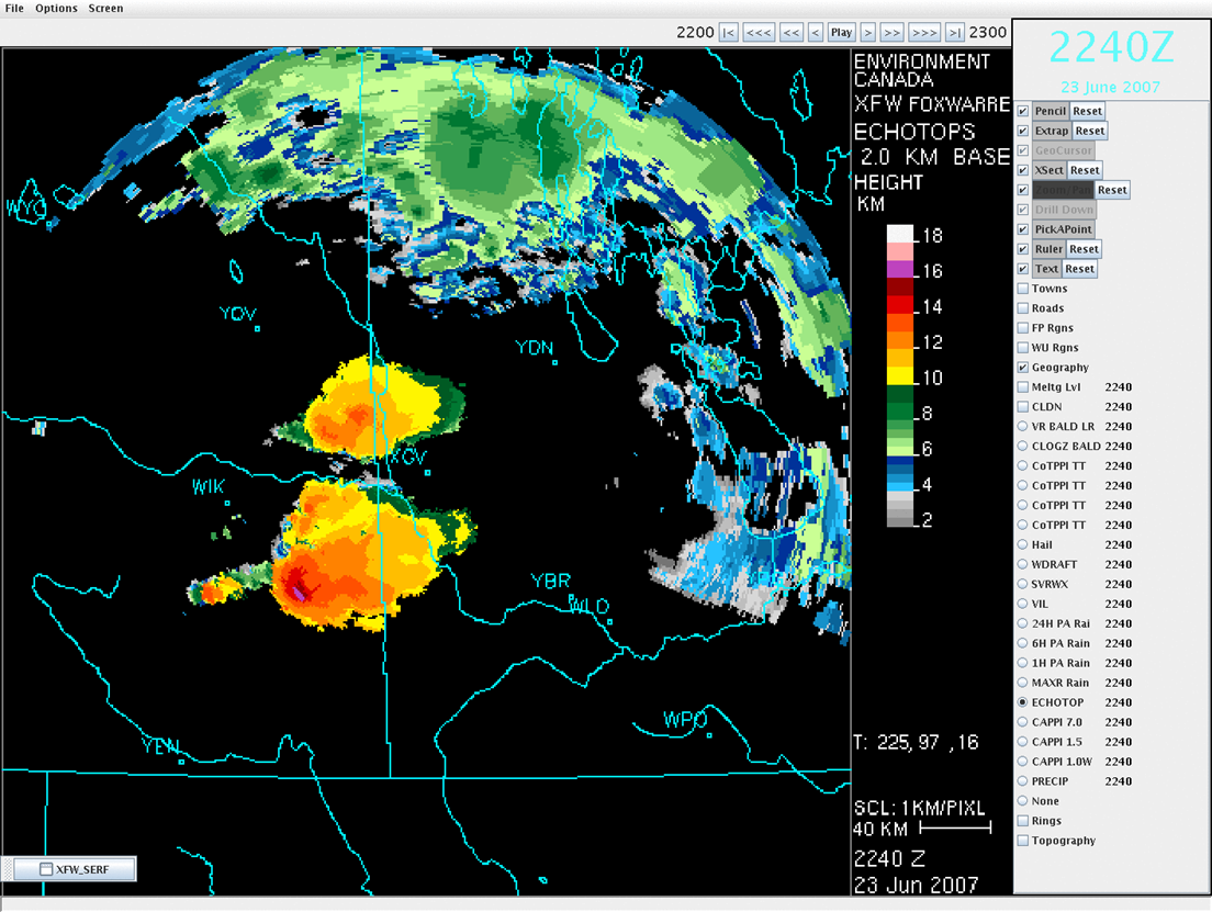
Smoothed echo top product. Note the clarify of the core, with top above 18 km clearly visible.
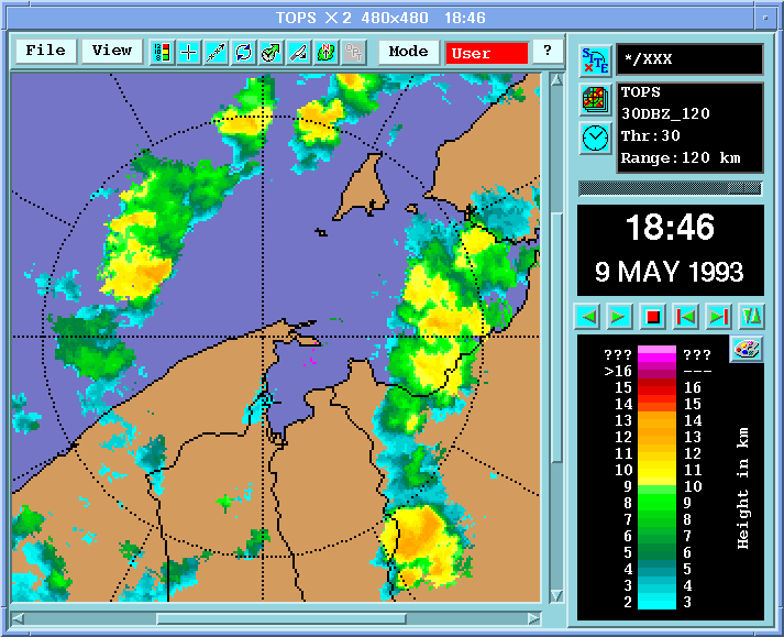
In Europe, the analogous product is called TOPS. This example has a threshold value of 30 dBZ.