MaxR
The MAXR product is a two dimensional representation extracted from the three
dimensional volume scan data. It attempts to synthesize a volume of data
in a simple fashion, to indicate the stage and severity of a storm by displaying
the maximum reflectivity above a point on the Earth's surface above a given
minimum height (~2 km). In the early stages of a storm, the maximum reflectivities
are found aloft since that is where precipitation is initiated. Later
in the life cycle of the storm, the rain falls out and the maximum reflectivities
are found near the surface of the Earth. Therefore, a MAXR product in
combination with a low altitude CAPPI can be used to deduce the stage of the
life cycle of a storm and the maximum reflectivities may be used as a rough
indicator of the future intensity of the storm on the ground.
So the MAXR is created by searching for the maximum reflectivity above a certain
height in the volume scan data. The intended final product is an image
for the severe weather meteorologist.
The areal coverage is also computed. The area of a range bin is calculated as the product of the arc length times the range bin resolution.
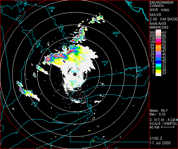
Example MaxR from the King City radar