RHI/AVCS
RHI (Range Height Indicator), so-called in Europe, is also commonly used on weather radars.
Example of an RHI display
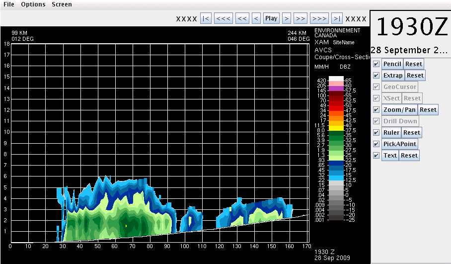
Arbitrary Vertical Cross-sections (AVCS):
The Arbitrary Vertical Cross-Section product is a height-distance display of
a reflectivity volume scan data on a vertical plane along a line segment
joining two points along the Earth's surface. The user generates the co-ordinates
of the line by specifying two points (see the image below). The points
can be fixed and used in a product generation schedule or from the interactive
display browser display.
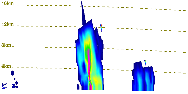
Image showing the first step in producing an AVCS. The scan is from the Mont Jolie, QC radar
To maintain the integrity of the data, the AVCS data is on a non-uniform grid both in height and distance. The vertical co-ordinate is the elevation scan number and the horizontal co-ordinate is a non-uniform sequence of distance. The distance locations of the horizontal grid are determined by where the radar grid points project onto the AVCS line.
While the cross-section line is specified by two points, (point A is the start and point B is the end point), the start of the cross-section line segment (called this point A1) is specified relative to the start point (A) as a displacement (where the direction from A to B is the positive direction) and the length of the cross-section is specified as a displacement from the point A1. The rationale for having "specifying points" and "actual points" is to make the horizontal labeling on a "easy to figure out" scale.
This product is invoked in batch and interactive mode. In interactive
mode, the line and the line segment is specified by the specifying points from
the interactive viewer.