Severe Weather Product
The Severe Weather Algorithm is based on an analysis of the three dimensional
volume scan data. The basic concept is that high reflectivities (>45 dBZ)
that occur high up in the thunderstorm (say > 10 km) get there because of very strong updrafts in the storm. The updraft strength is associated with severe weather development. For example, an intense updraft can support larger hail than a weaker one. The severe weather product says nothing about the presence of severe weather. It only indicates the presence of a strong updraft. Additional information is required to assess the severe weather potential of the storm. The severe weather product merely points to cells that require a second look from the meteorologist.
The algorithm is that when reflectivities greater than the threshold value is detected above a threshold altitude value, the geographical location is given a code value. The code value range from 1 through 4, and the higher the value, the more severe the weather. The intended output is an image that is generally very sparse. he classification codes are used in producing other image products. The current Severe Weather Threshold Table values are:
| Severe Weather Level | Height Threshold (km) | dBZ Threshold (dBZ) |
| 0 | 0 | 0 |
| 1 | 5.5 | 45 |
| 2 | 8.5 | 45 |
| 3 | 10.5 | 45 |
| 4 | 12.0 | 45 |
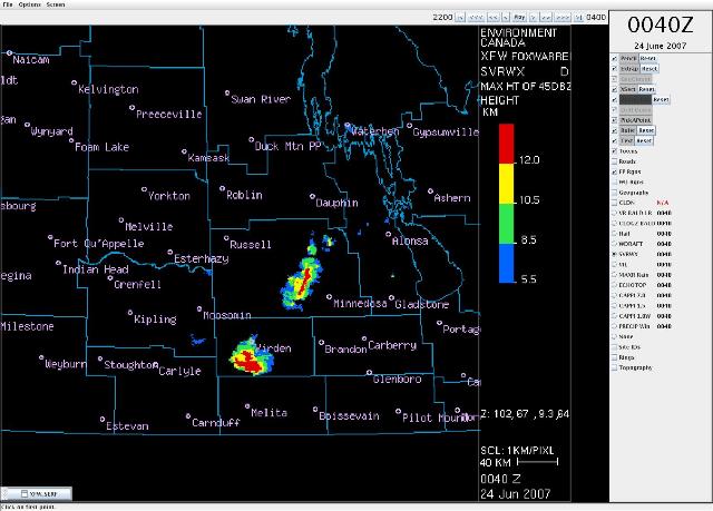
Sample severe weather product