Mosaic Generation
Consider the composite image below.
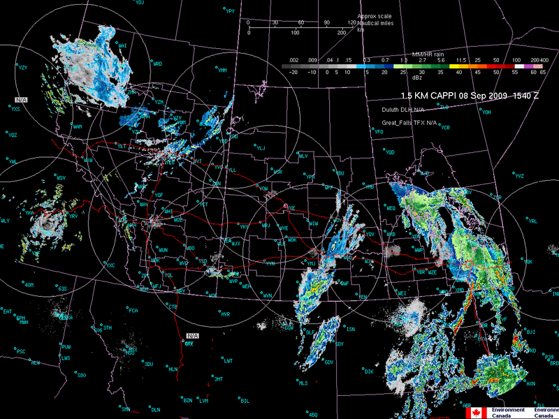
In compositing 1.5 km CAPPI images from not only the nine Prairie radars, but also a number of NWS 88D radars over the northern plains, there are a number of things to think about:
- areas with no radar overlap are can have echoes displayed as-is. There may be differences between echoes of a particular reflectivity from radar to radar, but overlap issues are non-existent.
- areas with radar overlap are problematic
- how to composite returns from S-band and C-band radars?
- how to composite returns from radars with different beam properties?
- how to composite returns that arrive at slightly different times?
- how to deal with returns from radars that are supposed to be the same but are often perceived by the meteorologist as being too "hot" or "cold"?
In general, there are a number of ways of dealing with the compositing of overlapping radar areas:
-
average the returns
-
take the maximum returns
-
take the returns from lowest radar bin
- take the returns from the closest radar bin
The commonly held belief is that the radars in Canada's weather radar network are equivalent. This is not true. Ten of the thirty radars in the Canadian network were brand-new Doppler radars, manufactured by Andrews and dubbed CWSR-98A; the other twenty are retro-fitted from earlier models, either manufactured by Enterprise (CWSR-98E) or Raytheon (CWSR-98R).
The 98A radars have larger antennas and smaller beamwidths, 0.65°, than do the retro-fitted 98E and 98R radars, which usually have larger beamwidths of 1.1° and up to 1.5 degrees. Identical echoes are given by identical reflectivities, regardless of whether the Z values are truly identical or not.

It can hardly be said that the output of the radars is equivalent, given the obvious long-term differences. These differences only add to the problems when generating composite images. While images such as these show qualitative differences, how do we go about assessing the differences quantitatively?
Averaging
Maximum Reflectivity
Using the maximum reflectivity may be problematic as the overlap area often samples bins from different elevations. Picking the maximum reflectivity to display on the composite may lead to the displaying of higher level echoes.
Lowest Radar Bin
At first glance, this might appear the best option, but what happens if the lowest radar bin is contaminated with AP?
Nearest to the Radar
Similar to the lowest radar bin, if one radar is more sensitive than the other, selection of the pixel nearest the radar might lead to unexpected results.
Best Practices
Composites of multiple radars are useful for keeping the big picture in mind or for alerting the meteorologist to potential problem areas. They should never be used as gospel because of problems with compositing overlap areas. Individual radar displays are preferable for assessing finer scale details, even those at the end of the radar's range.